Thursday, March 31, 2016

Koh Muk

Before leaving Koh Phetra (Thailand) on the morning of March 29th, there was an important boat job for Jordan. During yesterday's sail, we kept hearing an odd sporadic "whirring" noise in the boat coming on in short spells. At first, he thought it might be the autopilot motor but that possibility was eliminated by turning it off to find out the noise still came on. He couldn't identify it for quite a bit.

Finally he figured it was the windlass, and upon investigating, Jordan found that the remote switch that's kept in the forward outside anchor locker had gotten seawater in it and it was shorting the internal contact as though the switch button was pressed to make the windlass go on.

So temporarily we switched off the windlass breaker but then, before we raised the hook on the 29th, a fix was necessary. (We don't need the windlass to drop anchor but it sure is nice for raising the heavy anchor!) The disassembled switch was easily rinsed and cleaned with dialectic oil and was good to go. So it wasn't until 09:00 that we pulled up and made tracks from Koh Phetra.

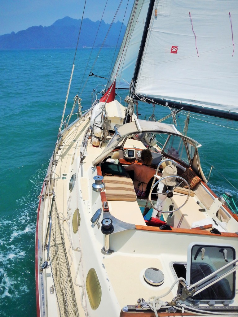
Our destination was another island new to us, named Koh Muk, a pleasant 5.5-hour beam reach sail away. Tucking in close to a cute beach flanked by towering limestone sentinels made for a splendid anchorage setting (N07°22.503' E099°17.187') in spite of the occasional noisy longtails with daytrippers from the mainland.

A Koh Muk moment

The main attraction here is Emerald Cave (aka Crystal Cave) which the cruising guide described as being accessed by a cave passage at sea level, 80 metres long most of which was in pitch blackness. The passage is punctuated at a small sandy, grey silica beach in an ethereal cave open to sky.

We decided to explore it the next morning before the tourists infested the contemplative nature of it all. But this first day, once the gawkers evaporated later that afternoon, we launched the dinghy to simply identify where the waterline cave entrance was which we easily found.

Shutting off the motor, we paddled just inside but without a flashlight, the interior passage quickly turned into a foreboding inky blackness stopping us short.

However on our retreat, a couple of other late yachtie arrivals in dinghies were coming in and invited us to follow with one of their extra flashlights. Paddling along through this surreal natural passage with the faint light showing eerie outlines of stalactites in the cavities above and other dead-end passages emanating ghostly whooshes conjured up images of a spooky Disneyland event. Motoring your dinghy in apparently is not allowed as it supposedly disturbs the bat population of the Cave. I guess someone motored in before us because we didn't see any evidence of bats which is too bad because that would have been the only thing missing to make it an all round creepy experience!

The end of the cave passage opened up in an ethereal setting of an inner cylindrical chamber a mere 60 metres in diameter completely surrounded by tall vertical limestone walls. Standing on the small sandy beach where even the few spoken words took on an otherworldly resonance, our sights were drawn up, up along vertical rock face laced with verdant lush growth to the late day's sky high above.

Inside Emerald Cave

(Flashlights can be seen in the dark passage above as more dinghies arrive.)

Even though we did the Cave thing the day of arrival, we decided to stay another day in this idyllic setting. Another boat job was needed (bleed some air out of the hydraulic steering ram) so Jordan did it this morning. Then the rest of the day we circumnavigated Koh Muk with the dinghy through some choppy waters at times and then did a lazy snorkel in the shadow of the cliffs' relatively clear and warm waters.

Monday, March 28, 2016

Koh Phetra

After an almost 8-hour close-hauled solid sail to windward, we arrived at a new destination for us in Thailand - Koh Phetra (N07°02.542' E099°28.251'). This  narrow 1.6 nautical mile long island's limestone cliffs rise sharply out of the sea, it's towering limestone walls giving us wind protection and safe anchorage on the west side.

We set anchor at a 7-metre depth close in against the vertical face where icicles of limestone hung out pointing down to the sea and where small caves and recesses made it ideal for swallows to build their nests only to be raided periodically by harvesters for the birdnest soup delicacy. A lonesome sea turtle came by to visit Sea Turtle on its way to who knows where. Hope he wasn't looking for a landing site here because apparently only the other side had any sort of beach.

Can you see Sea Turtle? (circled in red in centre)

We hopped in the dinghy and explored the west extremity and tried to greet a lone fisherman, but not a word of English did he seem to know, only the universal language of broad smiles and gestures were exchanged in passing.

Lonely fisherman

THAILAND harbours

We did our official check-out all under one roof by the Telaga marina on March 26th. Port Captain, Customs, and then Immigration were all very quick and easy. Then at 03:30 early in the morning under an almost full moon, we departed Langkawi Malaysia for a 25 nautical mile run west to Koh Lipe, Thailand. (Koh or Ko means island in Thai.) We had a great downwind sail all the way pushed by a 25-knot wind, arriving just after sunrise.

Today's sunrise...

We arrived at the exposed bay on the south side of Koh Lipe (N06°28.980' E099°18.209') in front of the village and the Thai Immigration office, a visit to which was our first order of business. Normally here, we would lay a deep anchor close to the reef but we were directed by some locals to take advantage of a mooring ball. Regardless, it was less than ideal conditions as there was a rolling swell that put us and the other boats a rockin'.

At the Immigration hut, fortunately we got there just in front of boatloads of day trippers that also were checking in and our officer was stressing about the workload, asking us to "hurry, hurry" when we were filling out the papers of official redundancy.

Then it was off to get some brekky and a Thailand SIM card with data for our smart phone so that we could access internet. That done, we left the place to the incoming throngs of tourists.

Boats of all kinds

We passed longtail boats with small loads of day sightseers heading to various spots around these islands and an unusual group just up the shore. The latter were indigenous nomadic people with no official status or individual identity who lived out of their boats wandering from island to island camping and fishing.

Our next stop was the beautiful lonely beaches on the west side of Koh Adang only 4 nautical miles away for some snorkelling to cool off, beachcombing, and rest and relaxation for the rest of the day (N06°31.470' E099°17.030').

...and today's sunset (taken from in the water)

We made sure to set our clocks back as Thailand is one hour earlier than Malaysia.

Friday, March 25, 2016

Go fast or go slow

Shortly after arriving back to Sea Turtle this year (Marina Island, Malaysia), feeling rushed, we realized it would be prudent to postpone our passage to the Mediterranean via the Red Sea this year. It was simply getting too late in the season. This wasn't a difficult decision. Not only did it relieve some anxiety, (after all, isn't this sailing life about slowing down and being stress free?), but postponing meant fitting in some other worthwhile endeavours at a relaxed rate.

We could now explore more of Thailand fabulous cruising areas that we missed out on before Did we mention Thailand is one of our favourite countries for many reasons and it's here we now have time to take advantage of good cheap boat labour in Phuket for some sprucing up of Sea Turtle. And Cambodia...we never did get there or visit the famous jungle ruins of Angkor Wat. So we should have a full and happy experience of SE Asia before departing here around the first of January for the passage to the Mediterranean.

A quote by Pico Iyer seems to say it best:
At some point, all the horizontal trips in the world stop compensating for the need to go deep, into somewhere challenging and unexpected; movement makes most sense when grounded in stillness. In an age of speed, I began to think, nothing could be more invigorating than going slow. In an age of distractions, nothing could feel more luxurious than paying attention. In an age of constant movement, nothing is more urgent than sitting still.
Go fast or go slow? Go slow!

Wednesday, March 23, 2016

Back to Langkawi

We were just hanging out by Cenang Beach (by the small town of Kampung Lubok Buaya, Langkawi Island, Malaysia) feeling the lazy sailors' life returning to us with the memories of the serious work of the last 10 months having drifted behind us and disappearing in our wake.

Weighing anchor late in the morning of March 21st, we headed out on a short 3-hour jump over to Telaga Harbour, still part of Langkawi Island, arriving at N06°21.754' E099°40.726'.

Getting close to Telaga...

A short 27-second video of us sailing to Langkawi can be seen at this YouTube link: https://youtu.be/DXJioxFb6_g. To see the Google Earth location, Sea Turtle is at approximately N06°19' E099°40'. (The same YouTube link is also at the right of the blog page listed under Other Links.)

Telaga, a nice out-of-the-way little port, is one we've visited before and is the final Malaysian stop, a checkout point for our short passage to the islands of Thailand. The port consists of a small inner harbour with a marina, a few waterfront restaurants, a gas station, and a wharf servicing a small ferry to and from the Thai islands close by. Right in front is an outer anchorage sheltered by 2 small barrier islands where we anchored along with about 30 other boats.

We noticed a few changes to service the increasing traffic and visitors since our last visit at Telaga. Some good and some at the expense of lost serenity.

Something that hasn't changed - the abundance of cute monkey troops! Still scavenging the shores and hanging out along the road to town, they wait for handouts and pose for pictures from passing tourists and locals.

Jordan was kept busy installing our new AIS. For landlubbers, this is an Automatic Identification System used by primarily commercial ships and regular cruisers. The information can be displayed on electronic charts, etc. Ships with this, show reciprocal identification and progress that helps for avoidance and for contact if necessary. Identifying and ship tracking if you will.

This is also helpful as commercial ships don't usually answer a radio call unless they are called by name. Some of Thailand now "requires" all boaters to have AIS installed before checking into their country.

Sunday, March 20, 2016

Dayang Bunting Island

We departed Penang Island at 08:30 on March 19th to continue our northward route of Malaysia. At first, we were slightly detoured to head close to shore to avoid several swimmers in the ocean for some type of event. That was a first as our jogs in our tracks are usually to avoid the plentiful fishing boats or commercial ships.

Now with our new Garmin GPS Receiver, we were once again laying down a track on our electronic charts.

With just a bit of wind blowing and the motor running, we put up the sails at noon for an extra push, then soon after, just full sails and no motor for a nice beat in the NW wind. This area was very hazy obscuring any land sighting until within about 10 nautical miles of any shore.

Shortly after dark at 20:15, we rattled the chain for the night at the southeast lee side of Dayang Bunting Island (N06°10.411' E099°49.134'), just south of Langkawi Island. We were awoken just after midnight to a change in wind which was then from the east and made our anchorage exposed and very rolly.

We had no choice but to crawl out of bed, raise the anchor, and sail to where we could re-anchor in a more protected spot. Normally, we don't like moving about islands in the dark but our charts are pretty accurate here and we were heading into a spot where we were once before, so with caution and vigilant attention to charts and depth sounder and with the help of some moonlight, a couple of hours later we dropped anchor on the northwest side of Dayang Bunting Island (N06°11.508' E099°47.192').

We awoke to a glorious morning. Sun shining, not a cloud in the sky, cute black monkeys on shore of the rising cliffs, and not another boat in sight. But don't get us wrong - civilization is close by - but all we could hear was the sound of the tide sloshing against the shore rocks. The peaceful morning tranquility was soon interrupted as we could hear the tourist boats bringing their throngs to the island lake not far away. So we departed at 10:30.

Leaving Dayang Bunting Island

Continuing north, we caught sight of friends Trevor and Jolanta on board SV Magnetic at anchor where we idled by to exchange hellos and the latest. Knowing we would see them soon again, we didn't stop and continued on a bit farther and anchored in front of Kampung Lubok Buaya town (N06°16.498' E099°43.638'), southwest Langkawi Island on March 20th.

THEN - our first jump into the ocean in almost a year! How refreshing!

Friday, March 18, 2016

George Town foray

Even though we were anchored in the wee early hours, we wanted to get an early start for shore duty. After we lowered the dinghy into the water, we headed to the Chew Jetty, the normal dinghy landing. There are about 4 Chinese jetties made up of wooden shanties built over the decades by Chinese to avoid property taxes. Their rickety structures are perched on piling stilts in the shallow mud flats. Now, they are somewhat of a tourist attraction and where most of the residents take advantage of their uniqueness by selling novelties to the sightseers.

On approach to tie up, a resident woman intercepted us and denied us landing rights, saying "Too many work boats need this tie-up so no good for you, no room for you. Go to next jetty." The landing prospect of the next jetty was obviously not suitable. We put 2 and 2 together and knew she expected us to use their boats for a fee to ferry us back and forth. A previous year (July 2014), we tied up there several times and supported the businesses of the jetty and even gave at their donation box, but oh well, not this time though - Boo Chew!

We hesitantly then tied up to the Customs dock close by and walked into George Town. Our first goal was to apply for a 2-month pre-entry Visa for Thailand. We went to our usual agent, signed the forms, and gave her our passports with 2 extra photos which she sent it away for a 24-hour turnaround.

Our second goal was to find help for our non-functional GPS Receiver. A technically knowledgeable young man in the large mall determined it was unfixable and sent us to the Garmin outlet in the same mall.

The extremely friendly and accommodating Chinese shop owner immediately said he could get a Garmin unit sent in from Kuala Lumpur overnight. Problem solved. We paid for it, he ordered it, and then he bought us lunch!

Unlike other parts of Malaysia, George Town has centuries of Chinese mercantile history and consequently a high concentration of Chinese residents that have continued in the proprietorship. Many years of characteristic architecture reflect this unique quality to the extent that UNESCO has given it a designation, and with that, now the old heritage buildings are starting to be restored for the attraction of the tourist.

Needing restoration

Various stages of restoration

On our return to our dinghy, a couple of Customs employees very politely "asked" us to not tie up there again and suggested an adjacent pier that was unused by the local ferry system.

Exhausted after so little sleep the night before and a lot of walking city pavement, it was nice to get back to the boat for rest to finish up the day. We found the heat more bearable here compared to down south at Marina Island, especially now that we had a nice breeze filtering throughout the hatches.

Wednesday, March 16, 2016

Finally floating

March 10th, after almost a month puttering away at various jobs on Sea Turtle while she was on the hard at Marina Island, we finally splashed her back into her natural environment. The first trip was short...less than a hundred metres to the dock where we would do some final preps (N04°12.690' E100°36.104').

Going to sea

It was so nice to retire aboard to the gentle sea motion that rocked us back into sea life.

Then on March 16th, we cast off at 08:30 for an ebullient first passage north. First stop: George Town of Penang Island (Malaysia).

Everything was working well, albeit 1 item - our GPS Receiver which connects to the computer charts and shows our passage track. So we dug out our handheld GPS - which hadn't been used in years - and occasionally checked lat and long to compare manually on the electronic charts. We felt confident to continue as this passage was familiar to us and planned on fixing the problem there.

We motored half the way before the onshore wind built and then had a glorious 8-hour sail under the watch of a half moon until we entered the lee side of Penang Island after dark. We decided to continue up the well marked and lit channel, and under 2 large bridges, to our anchorage in front of the Chew Jetty (N05°24.629' E100°20.568') in George Town at 02:30.

Wednesday, March 09, 2016

Malaysia maintenance

After a 10-month stay in Canada, which was longer than we wanted, we are now back at Sea Turtle in Malaysia at Marina Island in the northern part of the infamous Malacca Strait. Our total flight travel time, including layovers, was 23 hours 45 minutes. We routed from Victoria, Vancouver, Hong Kong, and finally Kuala Lumpur. We then boarded a 4-hour bus ride north to Marina Island. Whew - long day. Or should I say 2, as we also lost a day crossing the International Date Line.

So now back at the boat, the enervating temperatures at first had us dragging our butts, however we soon regained acclimation.

Even though Sea Turtle is in a secured marina yard alongside a fleet of other sleeping vessels, leaving her for long periods always makes us nervous worrying about deterioration in heat and humidity. But she fared better than expected. The bigger worries were lots of mold and cockroaches, however there was only a minor amount of mold and absolutely no bugs to deal with.

We immediately opened up all the windows and got to work cleaning her up. She needed a major spring cleaning and some reorganizing both inside and out.

The decks have now been washed clean of dirt and bird droppings, all the rusty stainless steel fittings and bars have been polished bright, the grimy upper hull has been waxed and buffed, the lower hull has been scraped and sanded of old bottom paint. And finally, all cupboards and storage areas have been cleaned and assessed of contents with old stuff discarded.

Bottom painting gave us problem. The heat and breeze made the already fast drying paint thicken up way too fast. The rollers became thick and sticky and the paint was globbing on unevenly. Thinning isn't recommended. So after the first frustrating coat, we postponed our scheduled launching and regrouped.

Jordan sanded out the uneven lumps and scuffed the whole bottom and got everything ready, even thoroughly mixing the paint. Then at daybreak the next morning, we got at it before the sun had a chance to build the heat of the day. This had been our worst experience ever for applying the anti-fouling bottom paint.

BEFORE: part polished, but bottom not yet painted

AFTER: polished and bottom painted

The above "after" photo was taken with Jordan's drone.

We took a room in a nearby hotel while working on the boat for a few reasons. The interior of Sea Turtle is in a tussle while cleaning and reorganizing, the fridge doesn't work while on the hard (keel-cooled type of fridge), and the hotel has a fridge and luxurious air conditioning.

But tomorrow morning we launch, back into the water again, after almost a year!!